GPS SURVEYING
GPS SURVEYING
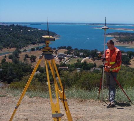
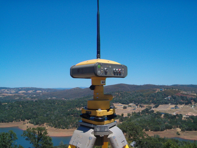
GPS (global positioning system) is a tool that utilizes broadcast satellite information to determine a single position or can be differentiated between multiple receivers to determine accurate ground vectors. GPS is utilized to enhance accuracy and measure great distances that would be almost impossible or very time consuming using conventional technologies. A.R. Divers has more than 25 years of actual GPS experience and owns and operates its own Topcon Hiper Lite + system, utilizing both American and Russian satelites.
GPS is most productive when spanning great distance as tying in control (datum) or measuring between points where line of sight is obstructed. In open areas kinematics (post processed or real time [RTK]) can be utilized by a single operator to collect large amounts of data in a short period of time. This is particularly helpful in collecting data for a GIS (geographic information system) or for field run topographic surveys. Static or fast static observation as used in control networks and boundary surveys can produce high accuracy results that consistently improve survey products.
in the office software programs, such as Topcon Tools: allow for quick downloads from receivers or data collectors; the import of data from CORS (continuous operating reference stations); reduction and adjustment of data; and converting of that data to a useful datum, such as NAD 83 and NAVD 88.
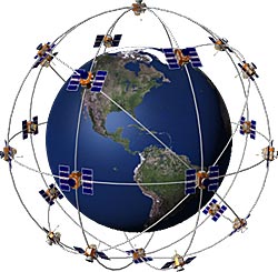
IF YOU REALLY WANT TO KNOW HOW IT WORKS VIEW FROM A SATELLITE
CONTROL SURVEYS
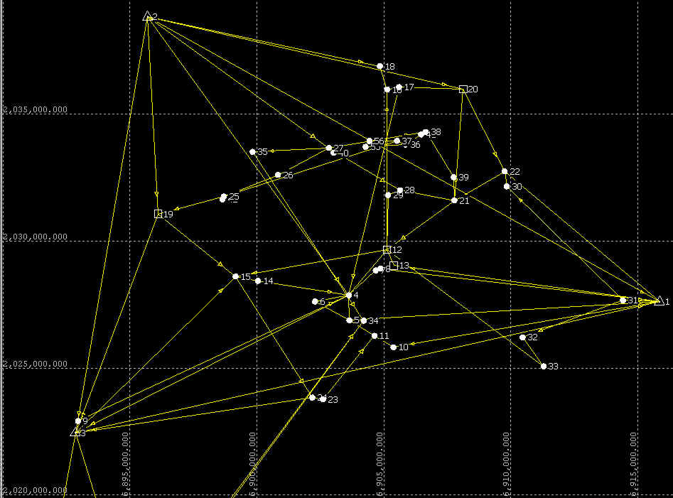
"A PROJECT IS AS GOOD AS ITS CONTROL."
A.R. Divers utilizes a combination of conventional and GPS measurements to construct the basic 3-d network that becomes the foundation for most survey projects. Whether utilized for the 10 acre sectional survey or complex community infrastructure projects, the basic process remains the same. By utilizing various state and federal monument densification networks, geodetic or state plane coordinate values can be derived with high accuracy.
![]()